

FRVC Projects

Patrol -Lytle Creek
Explore the stunning beauty of Lytle Creek with Fisheries Resource Volunteer Corps (FRVC) during our upcoming patrol! Nestled within the San Bernardino National Forest, Lytle Creek offers a tranquil setting for outdoor enthusiasts.
The Middle Fork of Lytle Creek is home to a naturally reproducing rainbow trout population, making it a popular spot for fishing and wildlife observation. With outstanding scenic, fish, and wildlife values, both the Middle and South Forks are considered eligible for National Wild & Scenic River status by the Forest Service.
Physical Difficulty: The Lytle Creek Patrol offers a moderate hiking experience, suitable for individuals comfortable with hiking one to two miles over rocky terrain at a beginning elevation of 3,300 feet.
Angler Survey Box & Special Fishing Regulations: There are no angler survey boxes or special fishing regulations on any of the Lytle Creek Forks. The standard California Department of Fish and Wildlife (CDFW) daily bag and possession limit of five fish applies on all forks of Lytle Creek.
Join this patrol along Lytle Creek, work towards preserving its natural beauty for generations to come. Contact the patrol leader to learn more using the link below.

Patrol- West Fork San Gabriel River
Join Fisheries Resource Volunteer Corps (FRVC) for a stream leader patrol training on the West Fork of the San Gabriel River! This scenic stream is a popular spot for fishing, camping, and hiking.
Meet patrol leaders at the San Gabriel Canyon Environmental Education Center.
Physical Difficulty: Easy- Mainly a driving patrol to Glenn Campground, but must be able to walk to, and along the stream a quarter of a mile. The patrol could also be along the river, 2 to 4 miles, with rocky terrain.
Please note that the patrol is subject to changes due to unforeseen circumstances, please always contact the patrol leader before attending.


Patrol- Deep Creek
Actively Recruiting Volunteers
🎣
Actively Recruiting Volunteers 🎣
Please Note: Deep Creek Patrol Dates are TBD please contact the patrol leader ASAP if you are interested in joining.
Join Fisheries Resource Volunteer Corps (FRVC) for a stream patrol on Deep Creek! This beautiful creek is home to a population of wild rainbow trout and is a popular spot for fishing, camping, and hiking. Deep Creek is a unique opportunity to explore a remote wilderness area while making a difference in preserving it.
Physical Difficulty: Upper and Middle Deep Creek - East to Moderate - Must be able to hike 1 to 4 miles with 600’ elevation change. Lower Deep Creek - Strenuous - Must be able to hike 3 to 14 miles on trails with rocky terrain with 800’ to 1000’ elevation change. The trail may be steep in places and can be slippery when wet. Some stream crossings may be required.
Directions to FRVC Shed: The FRVC Shed for Deep Creek is located at the North Shore Campground. The entrance to the North Shore Campground is on the left across from the hospital. Enter the campground staying to the right, to the end of the road. The FRVC shed is located in the detached garage adjacent to the Forest Service house.
Patrol Access Point & Boundaries: Access to Deep Creek in some areas can require a four-wheel drive, high clearance vehicle, especially early in the season. This patrol has multiple access points Devil’s Hole, Hot Springs, Spillway, Splinter’s Cabin, T-6, Fisherman Camp and at the Narrows.
Angler Survey Box & Fishing Regulations: There are angler survey boxes located at Devils Hole and at Splinter’s Cabin near the trailhead. Deep Creek is a designated Wild Trout Stream by the State of California with special fishing regulations.
Please note that this patrol is actively recruiting volunteers to join before scheduling the next patrol date and subject to changes, please get in touch with the patrol leader before attending.


Patrol- Mill Creek
Actively Recruiting
🎣
Actively Recruiting 🎣
Join Fisheries Resource Volunteer Corps (FRVC) for a stream patrol on Mill Creek and Mountain Home Creek! These beautiful creeks are popular spots for hiking. Mill Creek and Mountain Home Creek patrols offer a chance to explore a picturesque area while making a difference in preserving it.
Physical Difficulty: Mill Creek - Easy - Must be able to hike 1.3 miles over flat and rocky terrain at a 4,200' elevation. Mountain Home Creek - Easy - Must be able to hike 1 mile over rocky terrain.
Angler Survey Box & Special Fishing Regulations: There are no angler survey boxes or special fishing regulations on Mill Creek or Mountain Home Creek. The standard California Department of Fish and Wildlife daily bag and possession limit of five fish applies on Mill Creek and Mountain Home Creek.
Please note that the patrol is subject to changes due to unforeseen circumstances, please always contact the patrol leader before attending.

Patrol- East Fork of the San Gabriel River
Actively Recruiting Volunteers
🎣
Actively Recruiting Volunteers 🎣
Join Fisheries Resource Volunteer Corps (FRVC) for a stream patrol on the East Fork of the San Gabriel River!
Meet at the Gateway Center.
This patrol focuses on visitor engagement, litter pickup, and monitoring high-use areas along the East Fork. Expect heavy weekend traffic and warm conditions—sun protection, good footwear, and plenty of water are a must. Volunteers should always confirm attendance with the patrol leader in advance and notify them of any changes.
Please note that this patrol is actively recruiting volunteers to join and subject to changes. Please get in touch with the patrol leader before attending.

Patrol - Piru Creek
Actively Recruiting Volunteers
🎣
Actively Recruiting Volunteers 🎣
Join the Fisheries Resource Volunteer Corps (FRVC) for a stream patrol on Piru Creek! This scenic creek is home to a population of wild rainbow trout and is a popular spot for fishing, camping, and hiking.
Physical Difficulty: Moderate - Must be able to hike 2 to 4 miles on trail with rocky terrain. The trail may be steep in places and can be slippery when wet. Some stream crossings may be required.
The FRVC locker is located behind the Oak Flat Fire Station which is located at 38001 Golden State Hwy, Castaic, CA 91384, adjacent to the Oak Flat Campground, 3 miles south of Pyramid Lake. From Los Angeles, drive through Santa Clarita past Castaic and exit at Templin Highway. Turn left under the freeway until you come to a "T" in the road. Turn right at the "T" onto Golden State Hwy. Continue on Golden State Hwy 3 miles to the Oak Flat Station sign. Turn left at the sign and travel 1/4 mile to the Fire Station which is on the left. Park in the outer lot, as the parking next to the Fire Station is for Staff. The FRVC Locker is located at the rear of the fire station on the left side of the building.
Patrol Access Points & Boundaries: Return to Golden State Hwy and turn left. Travel 2 miles up the road to Frenchman's Flat to the parking area at the locked gate. Piru Creek is a short walk, just west of the parking area. The patrol starts at Frenchman's Flat upstream 1/4 mile to the old Highway 99 Bridge and continues 2 miles into the wild trout stream section that begins about 1/2 mile above the bridge
Angler Survey Box & Fishing Regulations: There is one angler survey right past the first bridge. There are wild trout in a section of this patrol. There are special regulations on the section above the waterfall, catch and release only with zero limit using only barbless hooks, and no bait.
Please note that the patrol is subject to changes due to unforeseen circumstances, please always contact the patrol leader before attending.


Patrol- San Antonio Creek and Icehouse Canyon
Get ready to explore the scenic San Antonio Creek as we embark on our patrol adventure. This patrol offers a range of options for volunteers:
A) Walking from the meeting point 1–2 miles on rocky terrain with several stream crossings.
B) Driving to various access points along the stream to patrol ½–1 mile stretches.
C) Patrolling the Icehouse Canyon Trail, anywhere from a short walk to 7 miles round trip.
Please bring a daypack containing the following items:
Your Patrol Performance Evaluation Form
Drinking Water
Sack Lunch
Sunscreen
Hat
Pen or Pencil
Long Pants
Comfortable Hiking Shoes
Work Gloves
Don’t forget to review the directions to the FRVC Shed on pages 38 & 39 of the Training Manual for additional guidance.
Confirmation of attendance is required. Please RSVP using the link below to secure your spot or if you have any questions.
This patrol is actively recruiting volunteers and is subject to change. Please contact the patrol leader before attending.

Tabling- East Fork Safety Outreach & Visitor Education
FRVC volunteers will be hosting a series of visitor education tabling events at the East Fork of the San Gabriel River to help share important safety information with hikers and recreationists visiting the Bridge to Nowhere trail.
This outreach effort supports a modified version of the “Turn Around Please Don’t Drown” public safety campaign, focusing on the dangers of high water conditions in mountain streams and flood-prone areas.
Each event day, volunteers will meet at the Gateway Center at 8:00 AM before heading to the outreach location for the day, typically Oaks Picnic Area or the Heaton Flats parking lot (Bridge to Nowhere trailhead). Volunteers will help engage visitors, share safety information, and encourage responsible recreation during high-water conditions.
Important Safety Facts We Share With Visitors
Just 6 inches of fast-moving water can knock an adult off their feet
12 inches of water can carry away most vehicles
More deaths occur each year from flooding than from any other thunderstorm-related hazard
It is never safe to walk into floodwaters
These outreach days are a great opportunity for volunteers to support public safety, connect with forest visitors, and help protect recreationists exploring the East Fork area.
Patrol- Deep Creek
Actively Recruiting Volunteers
🎣
Actively Recruiting Volunteers 🎣
Please Note: Deep Creek Patrol Dates are TBD please contact the patrol leader ASAP if you are interested in joining.
Join Fisheries Resource Volunteer Corps (FRVC) for a stream patrol on Deep Creek! This beautiful creek is home to a population of wild rainbow trout and is a popular spot for fishing, camping, and hiking. Deep Creek is a unique opportunity to explore a remote wilderness area while making a difference in preserving it.
Physical Difficulty: Upper and Middle Deep Creek - East to Moderate - Must be able to hike 1 to 4 miles with 600’ elevation change. Lower Deep Creek - Strenuous - Must be able to hike 3 to 14 miles on trails with rocky terrain with 800’ to 1000’ elevation change. The trail may be steep in places and can be slippery when wet. Some stream crossings may be required.
Directions to FRVC Shed: The FRVC Shed for Deep Creek is located at the North Shore Campground. The entrance to the North Shore Campground is on the left across from the hospital. Enter the campground staying to the right, to the end of the road. The FRVC shed is located in the detached garage adjacent to the Forest Service house.
Patrol Access Point & Boundaries: Access to Deep Creek in some areas can require a four-wheel drive, high clearance vehicle, especially early in the season. This patrol has multiple access points Devil’s Hole, Hot Springs, Spillway, Splinter’s Cabin, T-6, Fisherman Camp and at the Narrows.
Angler Survey Box & Fishing Regulations: There are angler survey boxes located at Devils Hole and at Splinter’s Cabin near the trailhead. Deep Creek is a designated Wild Trout Stream by the State of California with special fishing regulations.
Please note that this patrol is actively recruiting volunteers to join before scheduling the next patrol date and subject to changes, please get in touch with the patrol leader before attending.
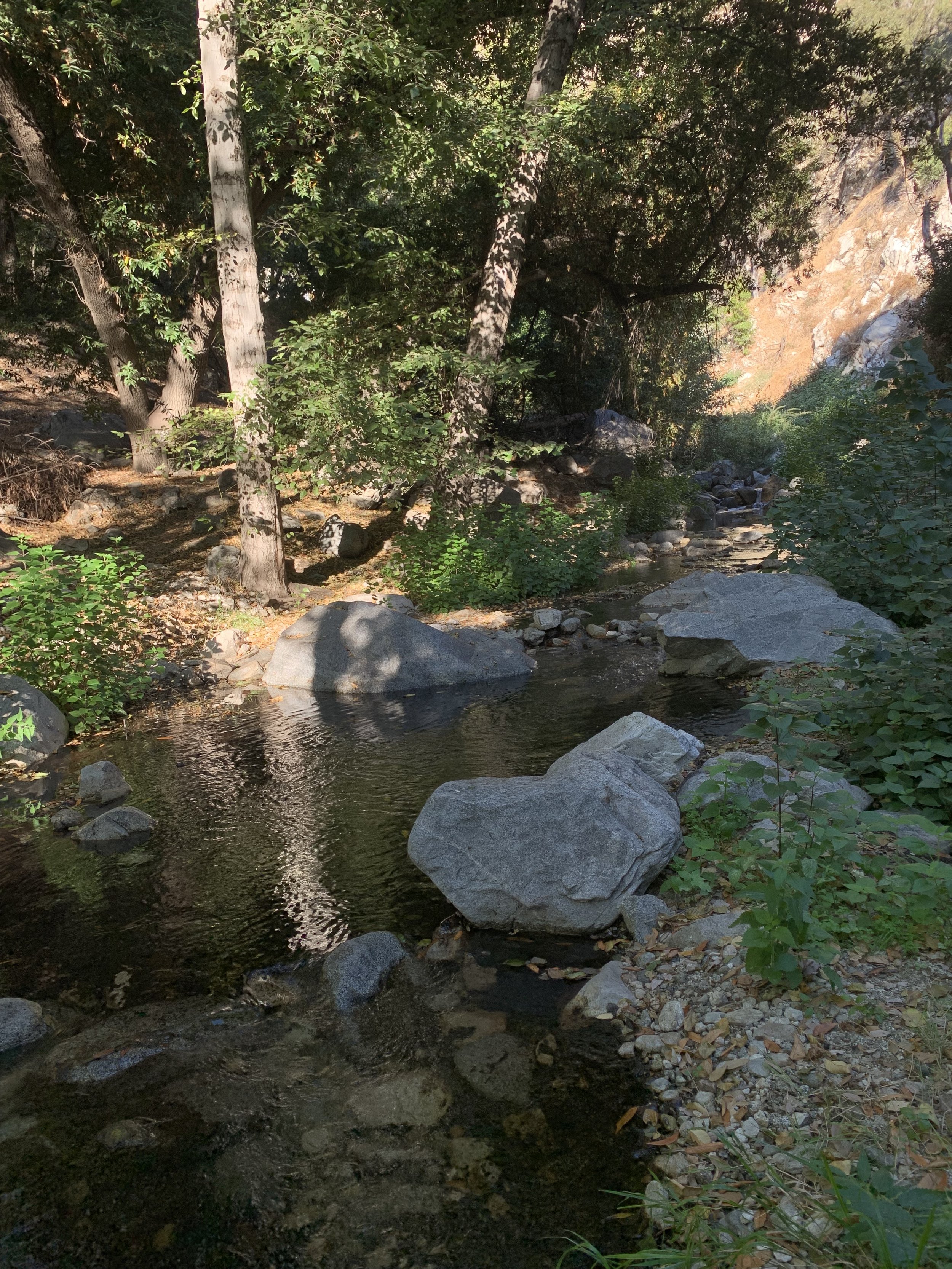
Patrol- Santa Anita Creek (Chantry Flat)
Join the Fisheries Resource Volunteer Corps (FRVC) for an upcoming patrol in the stunning Chantry Flat Recreation Area within the Angeles National Forest. Chantry Flat is known for its historic cabins, diverse wildlife, and over 40 miles of beautiful hiking trails. These patrols offer the opportunity to explore Big Santa Anita Creek, all while supporting conservation efforts to preserve this precious environment.
Patrol Trails:
Sturtevant Falls: Easy, 4 miles round trip, minimal water crossings.
First Water Loop: Easy, 2.5 miles with an uphill road walk at the end.
Hoegees Campground: Moderate, 4.25 miles with a 700' elevation change.
Spruce Grove Campground: Moderate to Difficult, 7.3 miles out and back with 1,000' elevation change.
The trail patrolled will depend upon the skill and interest of the volunteers.
Please note: Due to post-fire recovery efforts from the Bobcat Fire, trail specifics may vary. Volunteers should contact patrol leaders to confirm conditions and get carpool and parking details.
What to Bring:
Comfortable, weather-appropriate clothing
Day pack with essentials (water, snacks, sunscreen)
Fishing gear for those interested (fishing regulations apply)
Why Join?
By joining the Chantry Flat patrol, you'll be contributing to the preservation of Big Santa Anita Canyon's ecosystem, which supports a variety of species, including rainbow trout. Volunteers are crucial in keeping the trails clean, educating visitors, and helping maintain the health of this beautiful environment.
Get involved today—sign up for the patrol and help us protect this unique natural treasure!
For more details or to register, contact the patrol leader
Patrol - Piru Creek
Actively Recruiting Volunteers
🎣
Actively Recruiting Volunteers 🎣
Join the Fisheries Resource Volunteer Corps (FRVC) for a stream patrol on Piru Creek! This scenic creek is home to a population of wild rainbow trout and is a popular spot for fishing, camping, and hiking.
Physical Difficulty: Moderate - Must be able to hike 2 to 4 miles on trail with rocky terrain. The trail may be steep in places and can be slippery when wet. Some stream crossings may be required.
The FRVC locker is located behind the Oak Flat Fire Station which is located at 38001 Golden State Hwy, Castaic, CA 91384, adjacent to the Oak Flat Campground, 3 miles south of Pyramid Lake. From Los Angeles, drive through Santa Clarita past Castaic and exit at Templin Highway. Turn left under the freeway until you come to a "T" in the road. Turn right at the "T" onto Golden State Hwy. Continue on Golden State Hwy 3 miles to the Oak Flat Station sign. Turn left at the sign and travel 1/4 mile to the Fire Station which is on the left. Park in the outer lot, as the parking next to the Fire Station is for Staff. The FRVC Locker is located at the rear of the fire station on the left side of the building.
Patrol Access Points & Boundaries: Return to Golden State Hwy and turn left. Travel 2 miles up the road to Frenchman's Flat to the parking area at the locked gate. Piru Creek is a short walk, just west of the parking area. The patrol starts at Frenchman's Flat upstream 1/4 mile to the old Highway 99 Bridge and continues 2 miles into the wild trout stream section that begins about 1/2 mile above the bridge
Angler Survey Box & Fishing Regulations: There is one angler survey right past the first bridge. There are wild trout in a section of this patrol. There are special regulations on the section above the waterfall, catch and release only with zero limit using only barbless hooks, and no bait.
Please note that the patrol is subject to changes due to unforeseen circumstances, please always contact the patrol leader before attending.
Patrol- West Fork San Gabriel River
Join Fisheries Resource Volunteer Corps (FRVC) for a stream leader patrol training on the West Fork of the San Gabriel River! This scenic stream is a popular spot for fishing, camping, and hiking.
Meet patrol leaders at the San Gabriel Canyon Environmental Education Center.
Physical Difficulty: Easy- Mainly a driving patrol to Glenn Campground, but must be able to walk to, and along the stream a quarter of a mile. The patrol could also be along the river, 2 to 4 miles, with rocky terrain.
Please note that the patrol is subject to changes due to unforeseen circumstances, please always contact the patrol leader before attending.
Patrol -Lytle Creek
Explore the stunning beauty of Lytle Creek with Fisheries Resource Volunteer Corps (FRVC) during our upcoming patrol! Nestled within the San Bernardino National Forest, Lytle Creek offers a tranquil setting for outdoor enthusiasts.
The Middle Fork of Lytle Creek is home to a naturally reproducing rainbow trout population, making it a popular spot for fishing and wildlife observation. With outstanding scenic, fish, and wildlife values, both the Middle and South Forks are considered eligible for National Wild & Scenic River status by the Forest Service.
Physical Difficulty: The Lytle Creek Patrol offers a moderate hiking experience, suitable for individuals comfortable with hiking one to two miles over rocky terrain at a beginning elevation of 3,300 feet.
Angler Survey Box & Special Fishing Regulations: There are no angler survey boxes or special fishing regulations on any of the Lytle Creek Forks. The standard California Department of Fish and Wildlife (CDFW) daily bag and possession limit of five fish applies on all forks of Lytle Creek.
Join this patrol along Lytle Creek, work towards preserving its natural beauty for generations to come. Contact the patrol leader to learn more using the link below.
Patrol- San Antonio Creek and Icehouse Canyon
Get ready to explore the scenic San Antonio Creek as we embark on our patrol adventure. This patrol offers a range of options for volunteers:
A) Walking from the meeting point 1–2 miles on rocky terrain with several stream crossings.
B) Driving to various access points along the stream to patrol ½–1 mile stretches.
C) Patrolling the Icehouse Canyon Trail, anywhere from a short walk to 7 miles round trip.
Please bring a daypack containing the following items:
Your Patrol Performance Evaluation Form
Drinking Water
Sack Lunch
Sunscreen
Hat
Pen or Pencil
Long Pants
Comfortable Hiking Shoes
Work Gloves
Don’t forget to review the directions to the FRVC Shed on pages 38 & 39 of the Training Manual for additional guidance.
Confirmation of attendance is required. Please RSVP using the link below to secure your spot or if you have any questions.
This patrol is actively recruiting volunteers and is subject to change. Please contact the patrol leader before attending.
Patrol- North Fork of the San Gabriel River
Actively Recruiting Volunteers
🎣
Actively Recruiting Volunteers 🎣
Join Fisheries Resource Volunteer Corps (FRVC) for a stream patrol on the North Fork of the San Gabriel River!
Meet at the Gateway Center.
This patrol focuses on visitor engagement, litter pickup, and monitoring high-use areas along the North Fork. Expect heavy weekend traffic and warm conditions—sun protection, good footwear, and plenty of water are a must. Volunteers should always confirm attendance with the patrol leader in advance and notify them of any changes.
Please note that this patrol is actively recruiting volunteers to join and subject to changes. Please get in touch with the patrol leader before attending.
Patrol - Piru Creek
Actively Recruiting Volunteers
🎣
Actively Recruiting Volunteers 🎣
Join the Fisheries Resource Volunteer Corps (FRVC) for a stream patrol on Piru Creek! This scenic creek is home to a population of wild rainbow trout and is a popular spot for fishing, camping, and hiking.
Physical Difficulty: Moderate - Must be able to hike 2 to 4 miles on trail with rocky terrain. The trail may be steep in places and can be slippery when wet. Some stream crossings may be required.
The FRVC locker is located behind the Oak Flat Fire Station which is located at 38001 Golden State Hwy, Castaic, CA 91384, adjacent to the Oak Flat Campground, 3 miles south of Pyramid Lake. From Los Angeles, drive through Santa Clarita past Castaic and exit at Templin Highway. Turn left under the freeway until you come to a "T" in the road. Turn right at the "T" onto Golden State Hwy. Continue on Golden State Hwy 3 miles to the Oak Flat Station sign. Turn left at the sign and travel 1/4 mile to the Fire Station which is on the left. Park in the outer lot, as the parking next to the Fire Station is for Staff. The FRVC Locker is located at the rear of the fire station on the left side of the building.
Patrol Access Points & Boundaries: Return to Golden State Hwy and turn left. Travel 2 miles up the road to Frenchman's Flat to the parking area at the locked gate. Piru Creek is a short walk, just west of the parking area. The patrol starts at Frenchman's Flat upstream 1/4 mile to the old Highway 99 Bridge and continues 2 miles into the wild trout stream section that begins about 1/2 mile above the bridge
Angler Survey Box & Fishing Regulations: There is one angler survey right past the first bridge. There are wild trout in a section of this patrol. There are special regulations on the section above the waterfall, catch and release only with zero limit using only barbless hooks, and no bait.
Please note that the patrol is subject to changes due to unforeseen circumstances, please always contact the patrol leader before attending.
Patrol - Santa Anita Creek (Chantry Flat)
Join the Fisheries Resource Volunteer Corps (FRVC) for an upcoming patrol in the stunning Chantry Flat Recreation Area within the Angeles National Forest. Chantry Flat is known for its historic cabins, diverse wildlife, and over 40 miles of beautiful hiking trails. These patrols offer the opportunity to explore Big Santa Anita Creek, all while supporting conservation efforts to preserve this precious environment.
Patrol Trails:
Sturtevant Falls: Easy, 4 miles round trip, minimal water crossings.
First Water Loop: Easy, 2.5 miles with an uphill road walk at the end.
Hoegees Campground: Moderate, 4.25 miles with a 700' elevation change.
Spruce Grove Campground: Moderate to Difficult, 7.3 miles out and back with 1,000' elevation change.
The trail patrolled will depend upon the skill and interest of the volunteers.
Please note: Due to post-fire recovery efforts from the Bobcat Fire, trail specifics may vary. Volunteers should contact patrol leaders to confirm conditions and get carpool and parking details.
What to Bring:
Comfortable, weather-appropriate clothing
Day pack with essentials (water, snacks, sunscreen)
Fishing gear for those interested (fishing regulations apply)
Why Join?
By joining the Chantry Flat patrol, you'll be contributing to the preservation of Big Santa Anita Canyon's ecosystem, which supports a variety of species, including rainbow trout. Volunteers are crucial in keeping the trails clean, educating visitors, and helping maintain the health of this beautiful environment.
Get involved today—sign up for the patrol and help us protect this unique natural treasure!
For more details or to register, contact the patrol leader
Patrol - Piru Creek
Actively Recruiting Volunteers
🎣
Actively Recruiting Volunteers 🎣
Join the Fisheries Resource Volunteer Corps (FRVC) for a stream patrol on Piru Creek! This scenic creek is home to a population of wild rainbow trout and is a popular spot for fishing, camping, and hiking.
Physical Difficulty: Moderate - Must be able to hike 2 to 4 miles on trail with rocky terrain. The trail may be steep in places and can be slippery when wet. Some stream crossings may be required.
The FRVC locker is located behind the Oak Flat Fire Station which is located at 38001 Golden State Hwy, Castaic, CA 91384, adjacent to the Oak Flat Campground, 3 miles south of Pyramid Lake. From Los Angeles, drive through Santa Clarita past Castaic and exit at Templin Highway. Turn left under the freeway until you come to a "T" in the road. Turn right at the "T" onto Golden State Hwy. Continue on Golden State Hwy 3 miles to the Oak Flat Station sign. Turn left at the sign and travel 1/4 mile to the Fire Station which is on the left. Park in the outer lot, as the parking next to the Fire Station is for Staff. The FRVC Locker is located at the rear of the fire station on the left side of the building.
Patrol Access Points & Boundaries: Return to Golden State Hwy and turn left. Travel 2 miles up the road to Frenchman's Flat to the parking area at the locked gate. Piru Creek is a short walk, just west of the parking area. The patrol starts at Frenchman's Flat upstream 1/4 mile to the old Highway 99 Bridge and continues 2 miles into the wild trout stream section that begins about 1/2 mile above the bridge
Angler Survey Box & Fishing Regulations: There is one angler survey right past the first bridge. There are wild trout in a section of this patrol. There are special regulations on the section above the waterfall, catch and release only with zero limit using only barbless hooks, and no bait.
Please note that the patrol is subject to changes due to unforeseen circumstances, please always contact the patrol leader before attending.
Patrol -Lytle Creek
Explore the stunning beauty of Lytle Creek with Fisheries Resource Volunteer Corps (FRVC) during our upcoming patrol! Nestled within the San Bernardino National Forest, Lytle Creek offers a tranquil setting for outdoor enthusiasts.
The Middle Fork of Lytle Creek is home to a naturally reproducing rainbow trout population, making it a popular spot for fishing and wildlife observation. With outstanding scenic, fish, and wildlife values, both the Middle and South Forks are considered eligible for National Wild & Scenic River status by the Forest Service.
Physical Difficulty: The Lytle Creek Patrol offers a moderate hiking experience, suitable for individuals comfortable with hiking one to two miles over rocky terrain at a beginning elevation of 3,300 feet.
Angler Survey Box & Special Fishing Regulations: There are no angler survey boxes or special fishing regulations on any of the Lytle Creek Forks. The standard California Department of Fish and Wildlife (CDFW) daily bag and possession limit of five fish applies on all forks of Lytle Creek.
Join this patrol along Lytle Creek, work towards preserving its natural beauty for generations to come. Contact the patrol leader to learn more using the link below.
Patrol- West Fork San Gabriel River
Join Fisheries Resource Volunteer Corps (FRVC) for a stream leader patrol training on the West Fork of the San Gabriel River! This scenic stream is a popular spot for fishing, camping, and hiking.
Meet patrol leaders at the San Gabriel Canyon Environmental Education Center.
Physical Difficulty: Easy- Mainly a driving patrol to Glenn Campground, but must be able to walk to, and along the stream a quarter of a mile. The patrol could also be along the river, 2 to 4 miles, with rocky terrain.
Please note that the patrol is subject to changes due to unforeseen circumstances, please always contact the patrol leader before attending.
Patrol - Piru Creek
Actively Recruiting Volunteers
🎣
Actively Recruiting Volunteers 🎣
Join the Fisheries Resource Volunteer Corps (FRVC) for a stream patrol on Piru Creek! This scenic creek is home to a population of wild rainbow trout and is a popular spot for fishing, camping, and hiking.
Physical Difficulty: Moderate - Must be able to hike 2 to 4 miles on trail with rocky terrain. The trail may be steep in places and can be slippery when wet. Some stream crossings may be required.
The FRVC locker is located behind the Oak Flat Fire Station which is located at 38001 Golden State Hwy, Castaic, CA 91384, adjacent to the Oak Flat Campground, 3 miles south of Pyramid Lake. From Los Angeles, drive through Santa Clarita past Castaic and exit at Templin Highway. Turn left under the freeway until you come to a "T" in the road. Turn right at the "T" onto Golden State Hwy. Continue on Golden State Hwy 3 miles to the Oak Flat Station sign. Turn left at the sign and travel 1/4 mile to the Fire Station which is on the left. Park in the outer lot, as the parking next to the Fire Station is for Staff. The FRVC Locker is located at the rear of the fire station on the left side of the building.
Patrol Access Points & Boundaries: Return to Golden State Hwy and turn left. Travel 2 miles up the road to Frenchman's Flat to the parking area at the locked gate. Piru Creek is a short walk, just west of the parking area. The patrol starts at Frenchman's Flat upstream 1/4 mile to the old Highway 99 Bridge and continues 2 miles into the wild trout stream section that begins about 1/2 mile above the bridge
Angler Survey Box & Fishing Regulations: There is one angler survey right past the first bridge. There are wild trout in a section of this patrol. There are special regulations on the section above the waterfall, catch and release only with zero limit using only barbless hooks, and no bait.
Please note that the patrol is subject to changes due to unforeseen circumstances, please always contact the patrol leader before attending.
Patrol- East Fork of the San Gabriel River
Actively Recruiting Volunteers
🎣
Actively Recruiting Volunteers 🎣
Join Fisheries Resource Volunteer Corps (FRVC) for a stream patrol on the East Fork of the San Gabriel River!
Meet at the Gateway Center.
This patrol focuses on visitor engagement, litter pickup, and monitoring high-use areas along the East Fork. Expect heavy weekend traffic and warm conditions—sun protection, good footwear, and plenty of water are a must. Volunteers should always confirm attendance with the patrol leader in advance and notify them of any changes.
Please note that this patrol is actively recruiting volunteers to join and subject to changes. Please get in touch with the patrol leader before attending.
Patrol- San Antonio Creek and Icehouse Canyon
Get ready to explore the scenic San Antonio Creek as we embark on our patrol adventure. This patrol offers a range of options for volunteers:
A) Walking from the meeting point 1–2 miles on rocky terrain with several stream crossings.
B) Driving to various access points along the stream to patrol ½–1 mile stretches.
C) Patrolling the Icehouse Canyon Trail, anywhere from a short walk to 7 miles round trip.
Please bring a daypack containing the following items:
Your Patrol Performance Evaluation Form
Drinking Water
Sack Lunch
Sunscreen
Hat
Pen or Pencil
Long Pants
Comfortable Hiking Shoes
Work Gloves
Don’t forget to review the directions to the FRVC Shed on pages 38 & 39 of the Training Manual for additional guidance.
Confirmation of attendance is required. Please RSVP using the link below to secure your spot or if you have any questions.
This patrol is actively recruiting volunteers and is subject to change. Please contact the patrol leader before attending.
Santa Anita Creek (Chantry Flat) Patrol
Join the Fisheries Resource Volunteer Corps (FRVC) for an upcoming patrol in the stunning Chantry Flat Recreation Area within the Angeles National Forest. Chantry Flat is known for its historic cabins, diverse wildlife, and over 40 miles of beautiful hiking trails. These patrols offer the opportunity to explore Big Santa Anita Creek, all while supporting conservation efforts to preserve this precious environment.
Patrol Trails:
Sturtevant Falls: Easy, 4 miles round trip, minimal water crossings.
First Water Loop: Easy, 2.5 miles with an uphill road walk at the end.
Hoegees Campground: Moderate, 4.25 miles with a 700' elevation change.
Spruce Grove Campground: Moderate to Difficult, 7.3 miles out and back with 1,000' elevation change.
The trail patrolled will depend upon the skill and interest of the volunteers.
Please note: Due to post-fire recovery efforts from the Bobcat Fire, trail specifics may vary. Volunteers should contact patrol leaders to confirm conditions and get carpool and parking details.
What to Bring:
Comfortable, weather-appropriate clothing
Day pack with essentials (water, snacks, sunscreen)
Fishing gear for those interested (fishing regulations apply)
Why Join?
By joining the Chantry Flat patrol, you'll be contributing to the preservation of Big Santa Anita Canyon's ecosystem, which supports a variety of species, including rainbow trout. Volunteers are crucial in keeping the trails clean, educating visitors, and helping maintain the health of this beautiful environment.
Get involved today—sign up for the patrol and help us protect this unique natural treasure!
For more details or to register, contact the patrol leader
Patrol - Piru Creek
Actively Recruiting Volunteers
🎣
Actively Recruiting Volunteers 🎣
Join the Fisheries Resource Volunteer Corps (FRVC) for a stream patrol on Piru Creek! This scenic creek is home to a population of wild rainbow trout and is a popular spot for fishing, camping, and hiking.
Physical Difficulty: Moderate - Must be able to hike 2 to 4 miles on trail with rocky terrain. The trail may be steep in places and can be slippery when wet. Some stream crossings may be required.
The FRVC locker is located behind the Oak Flat Fire Station which is located at 38001 Golden State Hwy, Castaic, CA 91384, adjacent to the Oak Flat Campground, 3 miles south of Pyramid Lake. From Los Angeles, drive through Santa Clarita past Castaic and exit at Templin Highway. Turn left under the freeway until you come to a "T" in the road. Turn right at the "T" onto Golden State Hwy. Continue on Golden State Hwy 3 miles to the Oak Flat Station sign. Turn left at the sign and travel 1/4 mile to the Fire Station which is on the left. Park in the outer lot, as the parking next to the Fire Station is for Staff. The FRVC Locker is located at the rear of the fire station on the left side of the building.
Patrol Access Points & Boundaries: Return to Golden State Hwy and turn left. Travel 2 miles up the road to Frenchman's Flat to the parking area at the locked gate. Piru Creek is a short walk, just west of the parking area. The patrol starts at Frenchman's Flat upstream 1/4 mile to the old Highway 99 Bridge and continues 2 miles into the wild trout stream section that begins about 1/2 mile above the bridge
Angler Survey Box & Fishing Regulations: There is one angler survey right past the first bridge. There are wild trout in a section of this patrol. There are special regulations on the section above the waterfall, catch and release only with zero limit using only barbless hooks, and no bait.
Please note that the patrol is subject to changes due to unforeseen circumstances, please always contact the patrol leader before attending.
Patrol -Lytle Creek
Explore the stunning beauty of Lytle Creek with Fisheries Resource Volunteer Corps (FRVC) during our upcoming patrol! Nestled within the San Bernardino National Forest, Lytle Creek offers a tranquil setting for outdoor enthusiasts.
The Middle Fork of Lytle Creek is home to a naturally reproducing rainbow trout population, making it a popular spot for fishing and wildlife observation. With outstanding scenic, fish, and wildlife values, both the Middle and South Forks are considered eligible for National Wild & Scenic River status by the Forest Service.
Physical Difficulty: The Lytle Creek Patrol offers a moderate hiking experience, suitable for individuals comfortable with hiking one to two miles over rocky terrain at a beginning elevation of 3,300 feet.
Angler Survey Box & Special Fishing Regulations: There are no angler survey boxes or special fishing regulations on any of the Lytle Creek Forks. The standard California Department of Fish and Wildlife (CDFW) daily bag and possession limit of five fish applies on all forks of Lytle Creek.
Join this patrol along Lytle Creek, work towards preserving its natural beauty for generations to come. Contact the patrol leader to learn more using the link below.
Patrol- West Fork San Gabriel River
Join Fisheries Resource Volunteer Corps (FRVC) for a stream leader patrol training on the West Fork of the San Gabriel River! This scenic stream is a popular spot for fishing, camping, and hiking.
Meet patrol leaders at the San Gabriel Canyon Environmental Education Center.
Physical Difficulty: Easy- Mainly a driving patrol to Glenn Campground, but must be able to walk to, and along the stream a quarter of a mile. The patrol could also be along the river, 2 to 4 miles, with rocky terrain.
Please note that the patrol is subject to changes due to unforeseen circumstances, please always contact the patrol leader before attending.
Patrol- North Fork of the San Gabriel River
Actively Recruiting Volunteers
🎣
Actively Recruiting Volunteers 🎣
Join Fisheries Resource Volunteer Corps (FRVC) for a stream patrol on the North Fork of the San Gabriel River!
Meet at the Gateway Center.
This patrol focuses on visitor engagement, litter pickup, and monitoring high-use areas along the North Fork. Expect heavy weekend traffic and warm conditions—sun protection, good footwear, and plenty of water are a must. Volunteers should always confirm attendance with the patrol leader in advance and notify them of any changes.
Please note that this patrol is actively recruiting volunteers to join and subject to changes. Please get in touch with the patrol leader before attending.
Patrol - Piru Creek
Actively Recruiting Volunteers
🎣
Actively Recruiting Volunteers 🎣
Join the Fisheries Resource Volunteer Corps (FRVC) for a stream patrol on Piru Creek! This scenic creek is home to a population of wild rainbow trout and is a popular spot for fishing, camping, and hiking.
Physical Difficulty: Moderate - Must be able to hike 2 to 4 miles on trail with rocky terrain. The trail may be steep in places and can be slippery when wet. Some stream crossings may be required.
The FRVC locker is located behind the Oak Flat Fire Station which is located at 38001 Golden State Hwy, Castaic, CA 91384, adjacent to the Oak Flat Campground, 3 miles south of Pyramid Lake. From Los Angeles, drive through Santa Clarita past Castaic and exit at Templin Highway. Turn left under the freeway until you come to a "T" in the road. Turn right at the "T" onto Golden State Hwy. Continue on Golden State Hwy 3 miles to the Oak Flat Station sign. Turn left at the sign and travel 1/4 mile to the Fire Station which is on the left. Park in the outer lot, as the parking next to the Fire Station is for Staff. The FRVC Locker is located at the rear of the fire station on the left side of the building.
Patrol Access Points & Boundaries: Return to Golden State Hwy and turn left. Travel 2 miles up the road to Frenchman's Flat to the parking area at the locked gate. Piru Creek is a short walk, just west of the parking area. The patrol starts at Frenchman's Flat upstream 1/4 mile to the old Highway 99 Bridge and continues 2 miles into the wild trout stream section that begins about 1/2 mile above the bridge
Angler Survey Box & Fishing Regulations: There is one angler survey right past the first bridge. There are wild trout in a section of this patrol. There are special regulations on the section above the waterfall, catch and release only with zero limit using only barbless hooks, and no bait.
Please note that the patrol is subject to changes due to unforeseen circumstances, please always contact the patrol leader before attending.
Patrol- San Antonio Creek and Icehouse Canyon
Get ready to explore the scenic San Antonio Creek as we embark on our patrol adventure. This patrol offers a range of options for volunteers:
A) Walking from the meeting point 1–2 miles on rocky terrain with several stream crossings.
B) Driving to various access points along the stream to patrol ½–1 mile stretches.
C) Patrolling the Icehouse Canyon Trail, anywhere from a short walk to 7 miles round trip.
Please bring a daypack containing the following items:
Your Patrol Performance Evaluation Form
Drinking Water
Sack Lunch
Sunscreen
Hat
Pen or Pencil
Long Pants
Comfortable Hiking Shoes
Work Gloves
Don’t forget to review the directions to the FRVC Shed on pages 38 & 39 of the Training Manual for additional guidance.
Confirmation of attendance is required. Please RSVP using the link below to secure your spot or if you have any questions.
This patrol is actively recruiting volunteers and is subject to change. Please contact the patrol leader before attending.
Patrol -Santa Anita Creek (Chantry Flat)
Join the Fisheries Resource Volunteer Corps (FRVC) for an upcoming patrol in the stunning Chantry Flat Recreation Area within the Angeles National Forest. Chantry Flat is known for its historic cabins, diverse wildlife, and over 40 miles of beautiful hiking trails. These patrols offer the opportunity to explore Big Santa Anita Creek, all while supporting conservation efforts to preserve this precious environment.
Patrol Trails:
Sturtevant Falls: Easy, 4 miles round trip, minimal water crossings.
First Water Loop: Easy, 2.5 miles with an uphill road walk at the end.
Hoegees Campground: Moderate, 4.25 miles with a 700' elevation change.
Spruce Grove Campground: Moderate to Difficult, 7.3 miles out and back with 1,000' elevation change.
The trail patrolled will depend upon the skill and interest of the volunteers.
Please note: Due to post-fire recovery efforts from the Bobcat Fire, trail specifics may vary. Volunteers should contact patrol leaders to confirm conditions and get carpool and parking details.
What to Bring:
Comfortable, weather-appropriate clothing
Day pack with essentials (water, snacks, sunscreen)
Fishing gear for those interested (fishing regulations apply)
Why Join?
By joining the Chantry Flat patrol, you'll be contributing to the preservation of Big Santa Anita Canyon's ecosystem, which supports a variety of species, including rainbow trout. Volunteers are crucial in keeping the trails clean, educating visitors, and helping maintain the health of this beautiful environment.
Get involved today—sign up for the patrol and help us protect this unique natural treasure!
For more details or to register, contact the patrol leader

FRVC’s Annual Volunteer Appreciation and Luncheon
Save the Date for FRVC’s Annual Meeting
Join us to celebrate all of our volunteers!
This Year’s Guest Speaker will be announced soon!
🍽️ We will be serving lunch and desert,
🥇 awards will be presented,
🎁 volunteer appreciation gifts for everyone, raffles, and a chance to visit with all your FRVC friends!
👔 Be sure to wear Your FRVC shirt or uniform.
We really would like to see everyone attend Please RSVP ASAP so we can get an accurate headcount for food.

Patrol- Bear Creek
Actively Recruiting 🎣
Actively Recruiting 🎣
Join Fisheries Resource Volunteer Corps (FRVC) for a stream patrol on Bear Creek! This beautiful creek is home to a population of wild rainbow trout and is a popular spot for fishing, camping, and hiking. Bear Creek is one of the most remote streams in the San Bernardino National Forest and offers a unique opportunity to explore a pristine wilderness area while making a difference in preserving it.
This patrol is on Bear Creek at the confluence with the Santa Ana River.
Physical Difficulty - Moderate to easy.
Angler Survey Box & Fishing Regulations: There is one angler survey boxes on Bear Creek trailhead. at Slide Lake, near the Confluence of the Santa Ana River , and Glory Ridge and Camp Creek trailheads.
Bear Creek is a designated Wild Trout Stream by the State of California and has special fishing regulations.
Bear Creek Patrols meet at SBNF Headquarters at 602 S. Tippecanoe Ave., San Bernardino CA 92408 in the front parking lot.
Patrol Access Point & Boundaries: Access to Bear Creek in some areas can require a four-wheel drive, high clearance vehicle, especially early in the season.
Please note that this patrol is actively recruiting volunteers to join before scheduling the next patrol date and subject to changes, please get in touch with the patrol leader before attending.

Tabling- East Fork Safety Outreach & Visitor Education
FRVC volunteers will be hosting a series of visitor education tabling events at the East Fork of the San Gabriel River to help share important safety information with hikers and recreationists visiting the Bridge to Nowhere trail.
This outreach effort supports a modified version of the “Turn Around Please Don’t Drown” public safety campaign, focusing on the dangers of high water conditions in mountain streams and flood-prone areas.
Each event day, volunteers will meet at the Gateway Center at 8:00 AM before heading to the outreach location for the day, typically Oaks Picnic Area or the Heaton Flats parking lot (Bridge to Nowhere trailhead). Volunteers will help engage visitors, share safety information, and encourage responsible recreation during high-water conditions.
Important Safety Facts We Share With Visitors
Just 6 inches of fast-moving water can knock an adult off their feet
12 inches of water can carry away most vehicles
More deaths occur each year from flooding than from any other thunderstorm-related hazard
It is never safe to walk into floodwaters
These outreach days are a great opportunity for volunteers to support public safety, connect with forest visitors, and help protect recreationists exploring the East Fork area.
Patrol - Piru Creek
Actively Recruiting Volunteers
🎣
Actively Recruiting Volunteers 🎣
Join the Fisheries Resource Volunteer Corps (FRVC) for a stream patrol on Piru Creek! This scenic creek is home to a population of wild rainbow trout and is a popular spot for fishing, camping, and hiking.
Physical Difficulty: Moderate - Must be able to hike 2 to 4 miles on trail with rocky terrain. The trail may be steep in places and can be slippery when wet. Some stream crossings may be required.
The FRVC locker is located behind the Oak Flat Fire Station which is located at 38001 Golden State Hwy, Castaic, CA 91384, adjacent to the Oak Flat Campground, 3 miles south of Pyramid Lake. From Los Angeles, drive through Santa Clarita past Castaic and exit at Templin Highway. Turn left under the freeway until you come to a "T" in the road. Turn right at the "T" onto Golden State Hwy. Continue on Golden State Hwy 3 miles to the Oak Flat Station sign. Turn left at the sign and travel 1/4 mile to the Fire Station which is on the left. Park in the outer lot, as the parking next to the Fire Station is for Staff. The FRVC Locker is located at the rear of the fire station on the left side of the building.
Patrol Access Points & Boundaries: Return to Golden State Hwy and turn left. Travel 2 miles up the road to Frenchman's Flat to the parking area at the locked gate. Piru Creek is a short walk, just west of the parking area. The patrol starts at Frenchman's Flat upstream 1/4 mile to the old Highway 99 Bridge and continues 2 miles into the wild trout stream section that begins about 1/2 mile above the bridge
Angler Survey Box & Fishing Regulations: There is one angler survey right past the first bridge. There are wild trout in a section of this patrol. There are special regulations on the section above the waterfall, catch and release only with zero limit using only barbless hooks, and no bait.
Please note that the patrol is subject to changes due to unforeseen circumstances, please always contact the patrol leader before attending.
Patrol- Santa Anita Creek (Chantry Flat)
Join the Fisheries Resource Volunteer Corps (FRVC) for an upcoming patrol in the stunning Chantry Flat Recreation Area within the Angeles National Forest. Chantry Flat is known for its historic cabins, diverse wildlife, and over 40 miles of beautiful hiking trails. These patrols offer the opportunity to explore Big Santa Anita Creek, all while supporting conservation efforts to preserve this precious environment.
Patrol Trails:
Sturtevant Falls: Easy, 4 miles round trip, minimal water crossings.
First Water Loop: Easy, 2.5 miles with an uphill road walk at the end.
Hoegees Campground: Moderate, 4.25 miles with a 700' elevation change.
Spruce Grove Campground: Moderate to Difficult, 7.3 miles out and back with 1,000' elevation change.
The trail patrolled will depend upon the skill and interest of the volunteers.
Please note: Due to post-fire recovery efforts from the Bobcat Fire, trail specifics may vary. Volunteers should contact patrol leaders to confirm conditions and get carpool and parking details.
What to Bring:
Comfortable, weather-appropriate clothing
Day pack with essentials (water, snacks, sunscreen)
Fishing gear for those interested (fishing regulations apply)
Why Join?
By joining the Chantry Flat patrol, you'll be contributing to the preservation of Big Santa Anita Canyon's ecosystem, which supports a variety of species, including rainbow trout. Volunteers are crucial in keeping the trails clean, educating visitors, and helping maintain the health of this beautiful environment.
Get involved today—sign up for the patrol and help us protect this unique natural treasure!
For more details or to register, contact the patrol leader

Patrol- Lake Fulmor Level Check
Join us outdoors for the Lake Fulmor Level Check. This patrol is a great way to spend time outside while supporting the health of our waterways and public lands. Volunteers will help monitor water levels and contribute valuable data to ongoing conservation efforts.
What to Bring:
Daypack
Drinking water
Your lunch
Weather-appropriate clothing
Be sure to check the weather and conditions the day before and dress accordingly for the forecasted temperatures. Please note that the patrol is subject to changes due to unforeseen circumstances, please always contact the patrol leader before attending.

Tabling- East Fork Safety Outreach & Visitor Education
FRVC volunteers will be hosting a series of visitor education tabling events at the East Fork of the San Gabriel River to help share important safety information with hikers and recreationists visiting the Bridge to Nowhere trail.
This outreach effort supports a modified version of the “Turn Around Please Don’t Drown” public safety campaign, focusing on the dangers of high water conditions in mountain streams and flood-prone areas.
Each event day, volunteers will meet at the Gateway Center at 8:00 AM before heading to the outreach location for the day, typically Oaks Picnic Area or the Heaton Flats parking lot (Bridge to Nowhere trailhead). Volunteers will help engage visitors, share safety information, and encourage responsible recreation during high-water conditions.
Important Safety Facts We Share With Visitors
Just 6 inches of fast-moving water can knock an adult off their feet
12 inches of water can carry away most vehicles
More deaths occur each year from flooding than from any other thunderstorm-related hazard
It is never safe to walk into floodwaters
These outreach days are a great opportunity for volunteers to support public safety, connect with forest visitors, and help protect recreationists exploring the East Fork area.
Patrol- Deep Creek
Actively Recruiting Volunteers
🎣
Actively Recruiting Volunteers 🎣
Please Note: Deep Creek Patrol Dates are TBD please contact the patrol leader ASAP if you are interested in joining.
Join Fisheries Resource Volunteer Corps (FRVC) for a stream patrol on Deep Creek! This beautiful creek is home to a population of wild rainbow trout and is a popular spot for fishing, camping, and hiking. Deep Creek is a unique opportunity to explore a remote wilderness area while making a difference in preserving it.
Physical Difficulty: Upper and Middle Deep Creek - East to Moderate - Must be able to hike 1 to 4 miles with 600’ elevation change. Lower Deep Creek - Strenuous - Must be able to hike 3 to 14 miles on trails with rocky terrain with 800’ to 1000’ elevation change. The trail may be steep in places and can be slippery when wet. Some stream crossings may be required.
Directions to FRVC Shed: The FRVC Shed for Deep Creek is located at the North Shore Campground. The entrance to the North Shore Campground is on the left across from the hospital. Enter the campground staying to the right, to the end of the road. The FRVC shed is located in the detached garage adjacent to the Forest Service house.
Patrol Access Point & Boundaries: Access to Deep Creek in some areas can require a four-wheel drive, high clearance vehicle, especially early in the season. This patrol has multiple access points Devil’s Hole, Hot Springs, Spillway, Splinter’s Cabin, T-6, Fisherman Camp and at the Narrows.
Angler Survey Box & Fishing Regulations: There are angler survey boxes located at Devils Hole and at Splinter’s Cabin near the trailhead. Deep Creek is a designated Wild Trout Stream by the State of California with special fishing regulations.
Please note that this patrol is actively recruiting volunteers to join before scheduling the next patrol date and subject to changes, please get in touch with the patrol leader before attending.
Tabling- East Fork Safety Outreach & Visitor Education
FRVC volunteers will be hosting a series of visitor education tabling events at the East Fork of the San Gabriel River to help share important safety information with hikers and recreationists visiting the Bridge to Nowhere trail.
This outreach effort supports a modified version of the “Turn Around Please Don’t Drown” public safety campaign, focusing on the dangers of high water conditions in mountain streams and flood-prone areas.
Each event day, volunteers will meet at the Gateway Center at 8:00 AM before heading to the outreach location for the day, typically Oaks Picnic Area or the Heaton Flats parking lot (Bridge to Nowhere trailhead). Volunteers will help engage visitors, share safety information, and encourage responsible recreation during high-water conditions.
Important Safety Facts We Share With Visitors
Just 6 inches of fast-moving water can knock an adult off their feet
12 inches of water can carry away most vehicles
More deaths occur each year from flooding than from any other thunderstorm-related hazard
It is never safe to walk into floodwaters
These outreach days are a great opportunity for volunteers to support public safety, connect with forest visitors, and help protect recreationists exploring the East Fork area.
Patrol- Bear Creek
Actively Recruiting 🎣
Actively Recruiting 🎣
Join Fisheries Resource Volunteer Corps (FRVC) for a stream patrol on Bear Creek! This beautiful creek is home to a population of wild rainbow trout and is a popular spot for fishing, camping, and hiking. Bear Creek is one of the most remote streams in the San Bernardino National Forest and offers a unique opportunity to explore a pristine wilderness area while making a difference in preserving it.
This patrol is on Bear Creek at the confluence with the Santa Ana River.
Physical Difficulty - Moderate to easy.
Angler Survey Box & Fishing Regulations: There is one angler survey boxes on Bear Creek trailhead. at Slide Lake, near the Confluence of the Santa Ana River , and Glory Ridge and Camp Creek trailheads.
Bear Creek is a designated Wild Trout Stream by the State of California and has special fishing regulations.
Bear Creek Patrols meet at SBNF Headquarters at 602 S. Tippecanoe Ave., San Bernardino CA 92408 in the front parking lot.
Patrol Access Point & Boundaries: Access to Bear Creek in some areas can require a four-wheel drive, high clearance vehicle, especially early in the season.
Please note that this patrol is actively recruiting volunteers to join before scheduling the next patrol date and subject to changes, please get in touch with the patrol leader before attending.
Patrol- San Antonio Creek and Icehouse Canyon
Get ready to explore the scenic San Antonio Creek as we embark on our patrol adventure. This patrol offers a range of options for volunteers:
A) Walking from the meeting point 1–2 miles on rocky terrain with several stream crossings.
B) Driving to various access points along the stream to patrol ½–1 mile stretches.
C) Patrolling the Icehouse Canyon Trail, anywhere from a short walk to 7 miles round trip.
Please bring a daypack containing the following items:
Your Patrol Performance Evaluation Form
Drinking Water
Sack Lunch
Sunscreen
Hat
Pen or Pencil
Long Pants
Comfortable Hiking Shoes
Work Gloves
Don’t forget to review the directions to the FRVC Shed on pages 38 & 39 of the Training Manual for additional guidance.
Confirmation of attendance is required. Please RSVP using the link below to secure your spot or if you have any questions.
This patrol is actively recruiting volunteers and is subject to change. Please contact the patrol leader before attending.
Patrol - Piru Creek
Actively Recruiting Volunteers
🎣
Actively Recruiting Volunteers 🎣
Join the Fisheries Resource Volunteer Corps (FRVC) for a stream patrol on Piru Creek! This scenic creek is home to a population of wild rainbow trout and is a popular spot for fishing, camping, and hiking.
Physical Difficulty: Moderate - Must be able to hike 2 to 4 miles on trail with rocky terrain. The trail may be steep in places and can be slippery when wet. Some stream crossings may be required.
The FRVC locker is located behind the Oak Flat Fire Station which is located at 38001 Golden State Hwy, Castaic, CA 91384, adjacent to the Oak Flat Campground, 3 miles south of Pyramid Lake. From Los Angeles, drive through Santa Clarita past Castaic and exit at Templin Highway. Turn left under the freeway until you come to a "T" in the road. Turn right at the "T" onto Golden State Hwy. Continue on Golden State Hwy 3 miles to the Oak Flat Station sign. Turn left at the sign and travel 1/4 mile to the Fire Station which is on the left. Park in the outer lot, as the parking next to the Fire Station is for Staff. The FRVC Locker is located at the rear of the fire station on the left side of the building.
Patrol Access Points & Boundaries: Return to Golden State Hwy and turn left. Travel 2 miles up the road to Frenchman's Flat to the parking area at the locked gate. Piru Creek is a short walk, just west of the parking area. The patrol starts at Frenchman's Flat upstream 1/4 mile to the old Highway 99 Bridge and continues 2 miles into the wild trout stream section that begins about 1/2 mile above the bridge
Angler Survey Box & Fishing Regulations: There is one angler survey right past the first bridge. There are wild trout in a section of this patrol. There are special regulations on the section above the waterfall, catch and release only with zero limit using only barbless hooks, and no bait.
Please note that the patrol is subject to changes due to unforeseen circumstances, please always contact the patrol leader before attending.
Patrol- North Fork of the San Gabriel River
Actively Recruiting Volunteers
🎣
Actively Recruiting Volunteers 🎣
Join Fisheries Resource Volunteer Corps (FRVC) for a stream patrol on the North Fork of the San Gabriel River!
Meet at the Gateway Center.
This patrol focuses on visitor engagement, litter pickup, and monitoring high-use areas along the North Fork. Expect heavy weekend traffic and warm conditions—sun protection, good footwear, and plenty of water are a must. Volunteers should always confirm attendance with the patrol leader in advance and notify them of any changes.
Please note that this patrol is actively recruiting volunteers to join and subject to changes. Please get in touch with the patrol leader before attending.
Tabling- East Fork Safety Outreach & Visitor Education
FRVC volunteers will be hosting a series of visitor education tabling events at the East Fork of the San Gabriel River to help share important safety information with hikers and recreationists visiting the Bridge to Nowhere trail.
This outreach effort supports a modified version of the “Turn Around Please Don’t Drown” public safety campaign, focusing on the dangers of high water conditions in mountain streams and flood-prone areas.
Each event day, volunteers will meet at the Gateway Center at 8:00 AM before heading to the outreach location for the day, typically Oaks Picnic Area or the Heaton Flats parking lot (Bridge to Nowhere trailhead). Volunteers will help engage visitors, share safety information, and encourage responsible recreation during high-water conditions.
Important Safety Facts We Share With Visitors
Just 6 inches of fast-moving water can knock an adult off their feet
12 inches of water can carry away most vehicles
More deaths occur each year from flooding than from any other thunderstorm-related hazard
It is never safe to walk into floodwaters
These outreach days are a great opportunity for volunteers to support public safety, connect with forest visitors, and help protect recreationists exploring the East Fork area.
Patrol -Lytle Creek
Explore the stunning beauty of Lytle Creek with Fisheries Resource Volunteer Corps (FRVC) during our upcoming patrol! Nestled within the San Bernardino National Forest, Lytle Creek offers a tranquil setting for outdoor enthusiasts.
The Middle Fork of Lytle Creek is home to a naturally reproducing rainbow trout population, making it a popular spot for fishing and wildlife observation. With outstanding scenic, fish, and wildlife values, both the Middle and South Forks are considered eligible for National Wild & Scenic River status by the Forest Service.
Physical Difficulty: The Lytle Creek Patrol offers a moderate hiking experience, suitable for individuals comfortable with hiking one to two miles over rocky terrain at a beginning elevation of 3,300 feet.
Angler Survey Box & Special Fishing Regulations: There are no angler survey boxes or special fishing regulations on any of the Lytle Creek Forks. The standard California Department of Fish and Wildlife (CDFW) daily bag and possession limit of five fish applies on all forks of Lytle Creek.
Join this patrol along Lytle Creek, work towards preserving its natural beauty for generations to come. Contact the patrol leader to learn more using the link below.
Patrol- West Fork San Gabriel River
Join Fisheries Resource Volunteer Corps (FRVC) for a stream leader patrol training on the West Fork of the San Gabriel River! This scenic stream is a popular spot for fishing, camping, and hiking.
Meet patrol leaders at the San Gabriel Canyon Environmental Education Center.
Physical Difficulty: Easy- Mainly a driving patrol to Glenn Campground, but must be able to walk to, and along the stream a quarter of a mile. The patrol could also be along the river, 2 to 4 miles, with rocky terrain.
Please note that the patrol is subject to changes due to unforeseen circumstances, please always contact the patrol leader before attending.
Patrol- Mill Creek
Actively Recruiting
🎣
Actively Recruiting 🎣
Join Fisheries Resource Volunteer Corps (FRVC) for a stream patrol on Mill Creek and Mountain Home Creek! These beautiful creeks are popular spots for hiking. Mill Creek and Mountain Home Creek patrols offer a chance to explore a picturesque area while making a difference in preserving it.
Physical Difficulty: Mill Creek - Easy - Must be able to hike 1.3 miles over flat and rocky terrain at a 4,200' elevation. Mountain Home Creek - Easy - Must be able to hike 1 mile over rocky terrain.
Angler Survey Box & Special Fishing Regulations: There are no angler survey boxes or special fishing regulations on Mill Creek or Mountain Home Creek. The standard California Department of Fish and Wildlife daily bag and possession limit of five fish applies on Mill Creek and Mountain Home Creek.
Please note that the patrol is subject to changes due to unforeseen circumstances, please always contact the patrol leader before attending.
Patrol- Lake Fulmor Level Check
Join us outdoors for the Lake Fulmor Level Check. This patrol is a great way to spend time outside while supporting the health of our waterways and public lands. Volunteers will help monitor water levels and contribute valuable data to ongoing conservation efforts.
What to Bring:
Daypack
Drinking water
Your lunch
Weather-appropriate clothing
Be sure to check the weather and conditions the day before and dress accordingly for the forecasted temperatures. Please note that the patrol is subject to changes due to unforeseen circumstances, please always contact the patrol leader before attending.
Patrol - Piru Creek
Actively Recruiting Volunteers
🎣
Actively Recruiting Volunteers 🎣
Join the Fisheries Resource Volunteer Corps (FRVC) for a stream patrol on Piru Creek! This scenic creek is home to a population of wild rainbow trout and is a popular spot for fishing, camping, and hiking.
Physical Difficulty: Moderate - Must be able to hike 2 to 4 miles on trail with rocky terrain. The trail may be steep in places and can be slippery when wet. Some stream crossings may be required.
The FRVC locker is located behind the Oak Flat Fire Station which is located at 38001 Golden State Hwy, Castaic, CA 91384, adjacent to the Oak Flat Campground, 3 miles south of Pyramid Lake. From Los Angeles, drive through Santa Clarita past Castaic and exit at Templin Highway. Turn left under the freeway until you come to a "T" in the road. Turn right at the "T" onto Golden State Hwy. Continue on Golden State Hwy 3 miles to the Oak Flat Station sign. Turn left at the sign and travel 1/4 mile to the Fire Station which is on the left. Park in the outer lot, as the parking next to the Fire Station is for Staff. The FRVC Locker is located at the rear of the fire station on the left side of the building.
Patrol Access Points & Boundaries: Return to Golden State Hwy and turn left. Travel 2 miles up the road to Frenchman's Flat to the parking area at the locked gate. Piru Creek is a short walk, just west of the parking area. The patrol starts at Frenchman's Flat upstream 1/4 mile to the old Highway 99 Bridge and continues 2 miles into the wild trout stream section that begins about 1/2 mile above the bridge
Angler Survey Box & Fishing Regulations: There is one angler survey right past the first bridge. There are wild trout in a section of this patrol. There are special regulations on the section above the waterfall, catch and release only with zero limit using only barbless hooks, and no bait.
Please note that the patrol is subject to changes due to unforeseen circumstances, please always contact the patrol leader before attending.
Patrol-Santa Anita Creek (Chantry Flat)
Join the Fisheries Resource Volunteer Corps (FRVC) for an upcoming patrol in the stunning Chantry Flat Recreation Area within the Angeles National Forest. Chantry Flat is known for its historic cabins, diverse wildlife, and over 40 miles of beautiful hiking trails. These patrols offer the opportunity to explore Big Santa Anita Creek, all while supporting conservation efforts to preserve this precious environment.
Patrol Trails:
Sturtevant Falls: Easy, 4 miles round trip, minimal water crossings.
First Water Loop: Easy, 2.5 miles with an uphill road walk at the end.
Hoegees Campground: Moderate, 4.25 miles with a 700' elevation change.
Spruce Grove Campground: Moderate to Difficult, 7.3 miles out and back with 1,000' elevation change.
The trail patrolled will depend upon the skill and interest of the volunteers.
Please note: Due to post-fire recovery efforts from the Bobcat Fire, trail specifics may vary. Volunteers should contact patrol leaders to confirm conditions and get carpool and parking details.
What to Bring:
Comfortable, weather-appropriate clothing
Day pack with essentials (water, snacks, sunscreen)
Fishing gear for those interested (fishing regulations apply)
Why Join?
By joining the Chantry Flat patrol, you'll be contributing to the preservation of Big Santa Anita Canyon's ecosystem, which supports a variety of species, including rainbow trout. Volunteers are crucial in keeping the trails clean, educating visitors, and helping maintain the health of this beautiful environment.
Get involved today—sign up for the patrol and help us protect this unique natural treasure!
For more details or to register, contact the patrol leader
Tabling- East Fork Safety Outreach & Visitor Education
FRVC volunteers will be hosting a series of visitor education tabling events at the East Fork of the San Gabriel River to help share important safety information with hikers and recreationists visiting the Bridge to Nowhere trail.
This outreach effort supports a modified version of the “Turn Around Please Don’t Drown” public safety campaign, focusing on the dangers of high water conditions in mountain streams and flood-prone areas.
Each event day, volunteers will meet at the Gateway Center at 8:00 AM before heading to the outreach location for the day, typically Oaks Picnic Area or the Heaton Flats parking lot (Bridge to Nowhere trailhead). Volunteers will help engage visitors, share safety information, and encourage responsible recreation during high-water conditions.
Important Safety Facts We Share With Visitors
Just 6 inches of fast-moving water can knock an adult off their feet
12 inches of water can carry away most vehicles
More deaths occur each year from flooding than from any other thunderstorm-related hazard
It is never safe to walk into floodwaters
These outreach days are a great opportunity for volunteers to support public safety, connect with forest visitors, and help protect recreationists exploring the East Fork area.
Tabling- East Fork Safety Outreach & Visitor Education
FRVC volunteers will be hosting a series of visitor education tabling events at the East Fork of the San Gabriel River to help share important safety information with hikers and recreationists visiting the Bridge to Nowhere trail.
This outreach effort supports a modified version of the “Turn Around Please Don’t Drown” public safety campaign, focusing on the dangers of high water conditions in mountain streams and flood-prone areas.
Each event day, volunteers will meet at the Gateway Center at 8:00 AM before heading to the outreach location for the day, typically Oaks Picnic Area or the Heaton Flats parking lot (Bridge to Nowhere trailhead). Volunteers will help engage visitors, share safety information, and encourage responsible recreation during high-water conditions.
Important Safety Facts We Share With Visitors
Just 6 inches of fast-moving water can knock an adult off their feet
12 inches of water can carry away most vehicles
More deaths occur each year from flooding than from any other thunderstorm-related hazard
It is never safe to walk into floodwaters
These outreach days are a great opportunity for volunteers to support public safety, connect with forest visitors, and help protect recreationists exploring the East Fork area.
Patrol- Bear Creek
Actively Recruiting 🎣
Actively Recruiting 🎣
Join Fisheries Resource Volunteer Corps (FRVC) for a stream patrol on Bear Creek! This beautiful creek is home to a population of wild rainbow trout and is a popular spot for fishing, camping, and hiking. Bear Creek is one of the most remote streams in the San Bernardino National Forest and offers a unique opportunity to explore a pristine wilderness area while making a difference in preserving it.
This patrol is on Bear Creek at the confluence with the Santa Ana River.
Physical Difficulty - Moderate to easy.
Angler Survey Box & Fishing Regulations: There is one angler survey boxes on Bear Creek trailhead. at Slide Lake, near the Confluence of the Santa Ana River , and Glory Ridge and Camp Creek trailheads.
Bear Creek is a designated Wild Trout Stream by the State of California and has special fishing regulations.
Bear Creek Patrols meet at SBNF Headquarters at 602 S. Tippecanoe Ave., San Bernardino CA 92408 in the front parking lot.
Patrol Access Point & Boundaries: Access to Bear Creek in some areas can require a four-wheel drive, high clearance vehicle, especially early in the season.
Please note that this patrol is actively recruiting volunteers to join before scheduling the next patrol date and subject to changes, please get in touch with the patrol leader before attending.
Patrol - Piru Creek
Actively Recruiting Volunteers
🎣
Actively Recruiting Volunteers 🎣
Join the Fisheries Resource Volunteer Corps (FRVC) for a stream patrol on Piru Creek! This scenic creek is home to a population of wild rainbow trout and is a popular spot for fishing, camping, and hiking.
Physical Difficulty: Moderate - Must be able to hike 2 to 4 miles on trail with rocky terrain. The trail may be steep in places and can be slippery when wet. Some stream crossings may be required.
The FRVC locker is located behind the Oak Flat Fire Station which is located at 38001 Golden State Hwy, Castaic, CA 91384, adjacent to the Oak Flat Campground, 3 miles south of Pyramid Lake. From Los Angeles, drive through Santa Clarita past Castaic and exit at Templin Highway. Turn left under the freeway until you come to a "T" in the road. Turn right at the "T" onto Golden State Hwy. Continue on Golden State Hwy 3 miles to the Oak Flat Station sign. Turn left at the sign and travel 1/4 mile to the Fire Station which is on the left. Park in the outer lot, as the parking next to the Fire Station is for Staff. The FRVC Locker is located at the rear of the fire station on the left side of the building.
Patrol Access Points & Boundaries: Return to Golden State Hwy and turn left. Travel 2 miles up the road to Frenchman's Flat to the parking area at the locked gate. Piru Creek is a short walk, just west of the parking area. The patrol starts at Frenchman's Flat upstream 1/4 mile to the old Highway 99 Bridge and continues 2 miles into the wild trout stream section that begins about 1/2 mile above the bridge
Angler Survey Box & Fishing Regulations: There is one angler survey right past the first bridge. There are wild trout in a section of this patrol. There are special regulations on the section above the waterfall, catch and release only with zero limit using only barbless hooks, and no bait.
Please note that the patrol is subject to changes due to unforeseen circumstances, please always contact the patrol leader before attending.
Mill Creek Stream Clean-Up and Recreational Dam Removal
Actively Recruiting
🎣
Actively Recruiting 🎣
FRVC will lead a Stream Clean-Up and Recreational Dam Removal Project on Mill Creek on Saturday, July 25, with approximately 30 young adults from the AAS Air Force ROTC group.
We are looking for 8 FRVC volunteers to help lead and support this project. Volunteer leaders play an important role in guiding participants, supporting safe cleanup practices, removing trash, and helping restore the natural flow and health of the stream.
Volunteer Information
FRVC volunteers should arrive at 8:00 AM at Thurman Flats Picnic Area, located approximately 2 miles past the Mill Creek Ranger Station on Highway 38. Volunteers should wear their Forest Service uniform or FRVC T-shirt.
The cleanup will begin at 9:00 AM and finish at 1:00 PM. After the cleanup, volunteers and participants will gather for lunch together at the picnic area.
This is a meaningful opportunity to support hands-on stewardship, mentor young adults in conservation service, and help protect Mill Creek’s stream habitat before the height of the summer season.
Please note that the patrol is subject to changes due to unforeseen circumstances, please always contact the patrol leader before attending.
Patrol- San Antonio Creek and Icehouse Canyon
Get ready to explore the scenic San Antonio Creek as we embark on our patrol adventure. This patrol offers a range of options for volunteers:
A) Walking from the meeting point 1–2 miles on rocky terrain with several stream crossings.
B) Driving to various access points along the stream to patrol ½–1 mile stretches.
C) Patrolling the Icehouse Canyon Trail, anywhere from a short walk to 7 miles round trip.
Please bring a daypack containing the following items:
Your Patrol Performance Evaluation Form
Drinking Water
Sack Lunch
Sunscreen
Hat
Pen or Pencil
Long Pants
Comfortable Hiking Shoes
Work Gloves
Don’t forget to review the directions to the FRVC Shed on pages 38 & 39 of the Training Manual for additional guidance.
Confirmation of attendance is required. Please RSVP using the link below to secure your spot or if you have any questions.
This patrol is actively recruiting volunteers and is subject to change. Please contact the patrol leader before attending.
Patrol- Deep Creek
Actively Recruiting Volunteers
🎣
Actively Recruiting Volunteers 🎣
Please Note: Deep Creek Patrol Dates are TBD please contact the patrol leader ASAP if you are interested in joining.
Join Fisheries Resource Volunteer Corps (FRVC) for a stream patrol on Deep Creek! This beautiful creek is home to a population of wild rainbow trout and is a popular spot for fishing, camping, and hiking. Deep Creek is a unique opportunity to explore a remote wilderness area while making a difference in preserving it.
Physical Difficulty: Upper and Middle Deep Creek - East to Moderate - Must be able to hike 1 to 4 miles with 600’ elevation change. Lower Deep Creek - Strenuous - Must be able to hike 3 to 14 miles on trails with rocky terrain with 800’ to 1000’ elevation change. The trail may be steep in places and can be slippery when wet. Some stream crossings may be required.
Directions to FRVC Shed: The FRVC Shed for Deep Creek is located at the North Shore Campground. The entrance to the North Shore Campground is on the left across from the hospital. Enter the campground staying to the right, to the end of the road. The FRVC shed is located in the detached garage adjacent to the Forest Service house.
Patrol Access Point & Boundaries: Access to Deep Creek in some areas can require a four-wheel drive, high clearance vehicle, especially early in the season. This patrol has multiple access points Devil’s Hole, Hot Springs, Spillway, Splinter’s Cabin, T-6, Fisherman Camp and at the Narrows.
Angler Survey Box & Fishing Regulations: There are angler survey boxes located at Devils Hole and at Splinter’s Cabin near the trailhead. Deep Creek is a designated Wild Trout Stream by the State of California with special fishing regulations.
Please note that this patrol is actively recruiting volunteers to join before scheduling the next patrol date and subject to changes, please get in touch with the patrol leader before attending.
Patrol- Lake Fulmor Level Check
Join us outdoors for the Lake Fulmor Level Check. This patrol is a great way to spend time outside while supporting the health of our waterways and public lands. Volunteers will help monitor water levels and contribute valuable data to ongoing conservation efforts.
What to Bring:
Daypack
Drinking water
Your lunch
Weather-appropriate clothing
Be sure to check the weather and conditions the day before and dress accordingly for the forecasted temperatures. Please note that the patrol is subject to changes due to unforeseen circumstances, please always contact the patrol leader before attending.
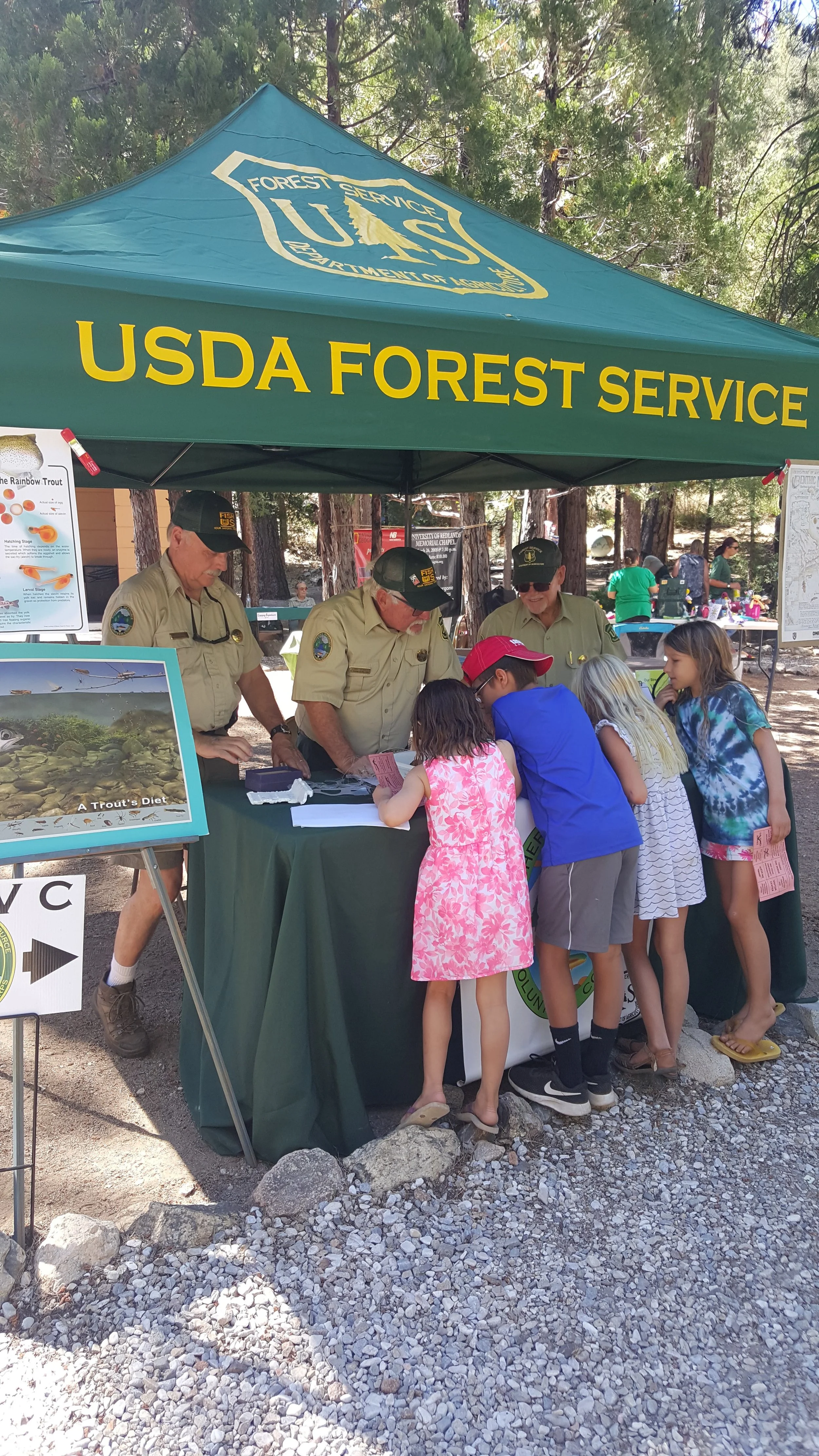
Forest Festival- Barton Flats
Join Us at the Barton Flats Forest Festival!
FRVC will be participating in the Barton Flat Forest Festival on Saturday, July 18, and we are looking for a few volunteers to help staff the FRVC booth.
This community event is a great opportunity to connect with forest visitors, share FRVC’s mission, and help introduce more people to the work volunteers do to protect, monitor, and educate in our local forests.
Volunteer Information
FRVC booth volunteers should arrive between 8:30 AM and 9:00 AM to help with setup. Volunteers should wear their Forest Service uniform or FRVC T-shirt. Volunteers are also invited to attend the barbecue hosted by SGWA at 4:00 PM after the festival.
To volunteer for this event, please email Sherri Craig using the button below.
Visitor Information
The Barton Flat Forest Festival will take place from 10:00 AM to 3:00 PM and will include a variety of hands-on activities, educational booths, and opportunities to learn more about outdoor recreation and conservation in the San Bernardino Mountains.
Visitors can look forward to using a crosscut saw to create a “tree cookie” branded with U.S. Forest Service and Smokey Bear logos, panning for gold, making a nature craft, learning about Friends of Big Bear Valley and their eagle cam, meeting search-and-rescue team members, and hearing from outdoor and conservation groups working to protect our natural resources.
The festival will also include information about the history of Serrano People in the San Bernardino Mountains, opportunities to visit with SGWA members who patrol and maintain trails in the San Gorgonio and Cucamonga wilderness areas, interpretive programs, SGWA musicians, snacks and beverages, and appearances from Smokey Bear throughout the day.
Patrol- West Fork San Gabriel River
Join Fisheries Resource Volunteer Corps (FRVC) for a stream leader patrol training on the West Fork of the San Gabriel River! This scenic stream is a popular spot for fishing, camping, and hiking.
Meet patrol leaders at the San Gabriel Canyon Environmental Education Center.
Physical Difficulty: Easy- Mainly a driving patrol to Glenn Campground, but must be able to walk to, and along the stream a quarter of a mile. The patrol could also be along the river, 2 to 4 miles, with rocky terrain.
Please note that the patrol is subject to changes due to unforeseen circumstances, please always contact the patrol leader before attending.
Patrol- East Fork of the San Gabriel River
Actively Recruiting Volunteers
🎣
Actively Recruiting Volunteers 🎣
Join Fisheries Resource Volunteer Corps (FRVC) for a stream patrol on the East Fork of the San Gabriel River!
Meet at the Gateway Center.
This patrol focuses on visitor engagement, litter pickup, and monitoring high-use areas along the East Fork. Expect heavy weekend traffic and warm conditions—sun protection, good footwear, and plenty of water are a must. Volunteers should always confirm attendance with the patrol leader in advance and notify them of any changes.
Please note that this patrol is actively recruiting volunteers to join and subject to changes. Please get in touch with the patrol leader before attending.